Category:18th-century maps of Madeira
Jump to navigation
Jump to search
Countries of Africa: Algeria · Angola · Benin · Cameroon · Cape Verde · Chad · Democratic Republic of the Congo · Republic of the Congo · Djibouti · Egypt‡ · Equatorial Guinea · Eritrea · Ethiopia · The Gambia · Ghana · Guinea · Ivory Coast · Libya · Madagascar · Mauritania · Morocco · Mozambique · Senegal · Sierra Leone · Somalia · South Africa · Sudan · Tanzania · Tunisia
Other areas: Canary Islands · Madeira · Western Sahara
‡: partly located in Africa
Other areas: Canary Islands · Madeira · Western Sahara
‡: partly located in Africa
Media in category "18th-century maps of Madeira"
The following 11 files are in this category, out of 11 total.
-
-
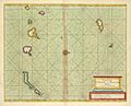 A chart of the Canarie and Madera Islands (ca. 1702-1707).jpg 760 × 615; 97 KB
-
 A chart of the Maderas and Canary Islands - G. Glas - btv1b531685860.jpg 6,017 × 7,752; 7.2 MB
-
 A chart of the Maderas and Canary Islands - G. Glas - btv1b53177457s.jpg 7,638 × 11,490; 8.92 MB
-
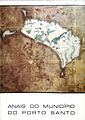 Anais do Município do Porto Santo.jpg 587 × 829; 69 KB
-

-
 Island of Madera; The dragon tree.jpg 506 × 760; 66 KB
-
 Mapa da Ilha da Madeira - Porto Santo por Bellin, 1770.jpg 1,132 × 845; 177 KB
-
 Mapa da Ilha da Madeira por Emanuel Bowen, 1747.jpg 1,015 × 848; 238 KB
-

-
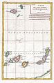
 The Canary Islands, with Madeira and Porto Santo (1780).jpg 408 × 600; 42 KB

.jpg)


.jpg)
.jpg)