Category:18th-century maps of Jerusalem
Jump to navigation
Jump to search
Media in category "18th-century maps of Jerusalem"
The following 51 files are in this category, out of 51 total.
-
 Nolin Map.Jpg 2,806 × 2,208; 1.57 MB
-

-
 Ca. 1730 map of Jerusalem by Matthaus Seutter.jpg 2,000 × 2,296; 1.57 MB
-
 1730 Street Map or Plan of Jerusalem - Geographicus - Jerusalem-uk-1730.jpg 2,189 × 2,771; 1.98 MB
-

-
 -Jerusalem- - Johann Daniel Herz Senior invent. delin. sculpsit et excudit ., -ca.1735-.jpg 3,000 × 2,022; 4.23 MB
-

-
 A Plan of Jerusalem and the Adjacent Country - Pococke Richard - 1745.jpg 1,994 × 2,000; 1.42 MB
-
 Jerusalem. Herman Moll. The Turkish Empire in Europe, Asia and Africa. 1752 (cropped).jpg 6,106 × 1,213; 7.81 MB
-

-
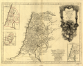 Palestine, Tribes, and Jerusalem WDL136.png 1,289 × 1,024; 2.67 MB
-
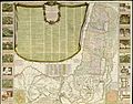
 1795 Haines and Son Pictorial Map of Jerusalem.jpg 8,500 × 5,103; 13.41 MB
-
 A description of Old Jerusalem - according to Villalpandus.jpg 2,700 × 2,247; 3.68 MB
-

-
 A new plan of the Old Jerusalem according to the author.jpg 2,770 × 2,209; 3.63 MB
-
 A Plan of Jerusalem and the adjacent country. - T.Jefferys sculp.jpg 2,550 × 2,418; 2.9 MB
-
 A plan of the city and country about Jerusalem.jpg 2,800 × 2,207; 2.74 MB
-
 A Plan of the City of Ierusalem (BM 1890,0415.225).jpg 2,500 × 2,196; 1.52 MB
-
 A plan of the Mount of Olives- According to our latest travellers.jpg 2,880 × 2,110; 3.29 MB
-
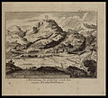 Abbildung des Oelbergs- nach den neuen Reisebeschreibungen.jpg 2,629 × 2,380; 3.3 MB
-
-
-
 De Olyf Berg- en't Dal Josaphats.jpg 4,133 × 2,681; 1.72 MB
-
 De Stadt Jerusalem - P. Mortier edit.jpg 2,000 × 3,103; 3.37 MB
-
 Der Ohl Berg Und Thal Josaphat.jpg 1,337 × 821; 336 KB
-
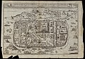
 Die Neue biltnus der H. Statt Jerusalem.jpg 1,149 × 731; 405 KB
-
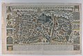
 Die Statt Jerusalem-17th-century.jpg 2,500 × 1,645; 1.81 MB
-

-

-
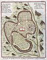
 Gerusalemme 1700.jpg 957 × 739; 193 KB
-
 Hierosolyma - Joh. Christoph Haffner Seel Erb. exc.jpg 3,900 × 1,575; 4.42 MB
-
 Hierosolyma Leopold.jpg 3,100 × 2,005; 3.04 MB
-
 Ierusalem as it now is, 1730.jpg 2,661 × 4,036; 1.35 MB
-
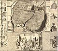
 Ierusalem as it now is-Crouch.jpg 1,595 × 2,389; 546 KB
-
 Ierusalem comme elle est a present - a Paris ches Daumont.jpg 3,000 × 2,085; 4.34 MB
-
 Ierusalem comme elle est a present - Fait par Aveline C.P.R.jpg 3,030 × 1,978; 4.23 MB
-
 J.B. d'Anville. Jérusalem.jpg 12,318 × 12,276; 13.32 MB
-
 Jan van Jagen. Ierusalem. 1770s.B.jpg 5,066 × 3,753; 4.1 MB
-
 Jan van Jagen. Ierusalem. 1770s.jpg 7,315 × 4,978; 6.95 MB
-
 Jean Baptiste Bourguignon d'Anville. La Palestine. 1767.Jerusalem.jpg 1,710 × 1,622; 528 KB
-
 Jean-François Daumont - Map of Jerusalem - 1780.jpg 12,560 × 8,331; 34.83 MB
-
 Jérusalem. La Palestine, pour l'Histoire des empereurs romains de M. Crévier. 1750.jpg 1,264 × 1,336; 323 KB
-
 Louis-Joseph Mondhare - Map of Jerusalem - 1770.jpg 3,080 × 1,967; 2.18 MB
-
 Plan de Jérusalem-1761.jpg 2,840 × 2,200; 3.18 MB
-
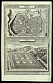
 Plan de l'Ancienne Jerusalem-1740.jpg 1,218 × 1,262; 280 KB
-

-
 Plan von Jerusalem-18th-century.jpg 2,050 × 3,024; 3.46 MB
-
 Prospeckt der heutigen Stadt Jerusalem - Fc. Kraus sc.jpg 2,920 × 2,114; 4.48 MB
-
 The antient city of Jerusalem and places adjacent H.Gavin Sculpt.jpg 1,112 × 800; 315 KB
-
 The Antient City of Jerusalem and places adjacent.jpg 1,223 × 852; 336 KB
-
 Timothe Gabashvili. Jerusalem (end of the 18th century).jpg 766 × 561; 458 KB


.jpg)


.jpg)


.jpg)
.jpg)