Category:18th-century maps of Eure
Jump to navigation
Jump to search
Media in category "18th-century maps of Eure"
The following 9 files are in this category, out of 9 total.
-

-
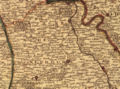 CampagneduNeubourg.jpg 1,184 × 875; 394 KB
-
 Carte de la région de Gasny.JPG 1,005 × 873; 323 KB
-
 Carte de Lieuvin.jpg 762 × 642; 376 KB
-
 GeneraliteRouen1774.jpg 727 × 704; 295 KB
-
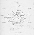 Le Theil-Nolent plan 18e siècle.jpg 1,151 × 1,188; 589 KB
-
 PaysdOuche.jpg 1,081 × 1,049; 405 KB
-
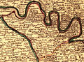 Roumois.jpg 1,137 × 843; 399 KB
-
 Vexinnormand.jpg 946 × 1,428; 448 KB
.jpg)


