Category:18 - 50 Canning Street
Jump to navigation
Jump to search
| Object location | | View all coordinates using: OpenStreetMap |
|---|
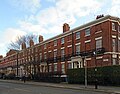
This is a category about listed building number 1356306. |
building in Liverpool, Merseyside, UK  | |||||
| Upload media | |||||
| Instance of | |||||
|---|---|---|---|---|---|
| Location | Liverpool, Merseyside, North West England, England | ||||
| Heritage designation |
| ||||
 | |||||
Media in category "18 - 50 Canning Street"
The following 6 files are in this category, out of 6 total.
-
 18 - 50 Canning Street 1.jpg 4,803 × 3,076; 6.77 MB
-
 18 - 50 Canning Street 2.jpg 4,373 × 3,409; 7.1 MB
-
 18-50 Canning Street, Liverpool - geograph.org.uk - 2906379.jpg 640 × 399; 176 KB
-
 29 & 31 Catharine Street.jpg 4,357 × 3,198; 6.93 MB
-
 Canning Street, Liverpool (6).JPG 4,320 × 3,240; 3.28 MB
-
 Canning Street, Liverpool (7).JPG 4,320 × 3,240; 3.13 MB


.JPG)
.JPG)