Category:1898 maps of Maryland
Jump to navigation
Jump to search
States of the United States: Alaska · California · Connecticut · Florida · Georgia · Illinois · Indiana · Iowa · Kentucky · Louisiana · Maine · Maryland · Massachusetts · Michigan · Minnesota · Mississippi · Missouri · Montana · New Hampshire · New Jersey · New Mexico · New York · North Carolina · North Dakota · Ohio · Oklahoma · Oregon · Pennsylvania · Rhode Island · South Carolina · South Dakota · Tennessee · Texas · Vermont · Virginia · Washington · West Virginia · Wisconsin – Washington, D.C.
Puerto Rico
Puerto Rico
| 1890 1891 1892 1894 1895 1897 1898 1899 |
Subcategories
This category has only the following subcategory.
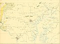
Media in category "1898 maps of Maryland"
The following 3 files are in this category, out of 3 total.
-
 (Map of the battlefield of Antietam LOC 2008621643.jpg 7,983 × 9,826; 11.98 MB
-
 (Map of the battlefield of Antietam LOC 2008621643.tif 7,983 × 9,826; 224.42 MB
-

_(14578499237).jpg)