Category:1890s maps of Vienna
Jump to navigation
Jump to search
Subcategories
This category has the following 3 subcategories, out of 3 total.
Media in category "1890s maps of Vienna"
The following 20 files are in this category, out of 20 total.
-
 Meyers b18 s1002 b1.png 750 × 660; 239 KB
-

-
 Meyers leiner Hand-atlas 1893 (73136714).jpg 6,368 × 9,553; 10.81 MB
-
 Neuester Plan von Wien, mit der neuen Bezirkseintheilung - btv1b53029018x (21 of 21).jpg 9,688 × 7,952; 17.77 MB
-
 1. Bezirk - Plan der Reichshaupt - & Residenzstadt Wien von Gustav Freytag (cropped).jpg 4,680 × 4,745; 6.01 MB
-
 Plan der Reichshaupt - & Residenzstadt Wien von Gustav Freytag.jpg 19,337 × 16,464; 87.12 MB
-
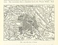 334 of 'The International Geography. ... Edited by H. R. Mill' (11288066305).jpg 1,400 × 1,093; 513 KB
-
 1899 detail map of Vienna.jpg 1,443 × 1,540; 520 KB
-

-

-

-

-

-

-
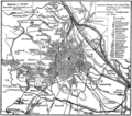
 Meyers Wien 1890 Dezember.jpg 750 × 685; 183 KB
-
 Ottakring-1892.png 5,024 × 2,290; 7.73 MB
-
 Stielers Handatlas 1891 20.jpg 5,050 × 4,200; 7.28 MB
-
 Wien Stadtplan 1892 Ausschnitt.jpg 1,275 × 1,744; 677 KB
-
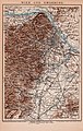 Wien und Umgebung Brockhaus 14 Aufl1898.jpg 7,372 × 11,626; 48.04 MB
-
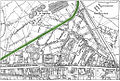 Wien-Simmering-Regulierungsplan-Schlachthausbahn-(1897-98).jpg 1,030 × 691; 627 KB

.jpg)
.jpg)
.jpg)
.jpg)

.jpg)

.jpg)
.jpg)
.jpg)
_(14578673070).jpg)
_(14765049252).jpg)


.jpg)