Category:1890s maps of Lithuania
Jump to navigation
Jump to search
Countries of Europe: Albania · Armenia‡ · Austria · Azerbaijan‡ · Belarus · Belgium · Bosnia and Herzegovina · Bulgaria · Croatia · Cyprus‡ · Czech Republic · Denmark · Estonia · Finland · France‡ · Georgia‡ · Germany · Greece · Hungary · Republic of Ireland · Italy · Latvia · Lithuania · Montenegro · Netherlands‡ · Norway · Poland · Portugal‡ · Romania · Russia‡ · Serbia · Slovakia · Slovenia · Spain‡ · Sweden · Switzerland · Turkey‡ · Ukraine · United Kingdom
Limited recognition: Abkhazia‡
‡: partly located in Europe
Limited recognition: Abkhazia‡
‡: partly located in Europe
Subcategories
This category has the following 2 subcategories, out of 2 total.
- 1890 maps of Lithuania (4 F)
- 1892 maps of Lithuania (4 F)
Media in category "1890s maps of Lithuania"
The following 15 files are in this category, out of 15 total.
-
 BATYUSHKOV(1890) p591.jpg 3,617 × 4,107; 9.65 MB
-
 Image taken from page 332 of 'Histoire d'un siècle' (11203766703).jpg 1,532 × 2,649; 966 KB
-
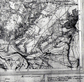
 Kauno Tvirtoves generalinis planas.jpg 397 × 307; 30 KB
-
 Leszczyniaki.png 625 × 608; 915 KB
-
 Grūšlaukė 1895.jpg 2,521 × 1,837; 1.58 MB
-
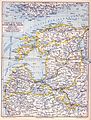 Meyerbaltikum.jpg 1,513 × 2,000; 1.26 MB
-
 Congress Poland map 19th century.jpg 1,275 × 1,526; 1.37 MB
-
 Kauno gub 1896.jpeg 7,827 × 6,135; 7.17 MB
-
 Privisl.jpg 1,275 × 1,591; 1.07 MB
-
 Сувалкская губерния 1896.jpg 390 × 509; 67 KB
-
 Vilna Governorate Map (1897).jpg 2,552 × 3,121; 1.55 MB
-
 Litauen BV042518395.jpg 9,392 × 6,813; 12.18 MB
-
 Litauen BV043717422.jpg 1,825 × 2,561; 492 KB
-
 Litauen BV043717442.jpg 4,393 × 1,625; 535 KB
-

_p591.jpg)
.jpg)


.jpg)


.jpg)