Category:1888 maps of Massachusetts
Jump to navigation
Jump to search
States of the United States: California · Connecticut · Florida · Georgia · Idaho · Illinois · Indiana · Iowa · Kansas · Massachusetts · Michigan · Minnesota · Missouri · Montana · New Hampshire · New York · North Carolina · North Dakota · Ohio · Oregon · Pennsylvania · South Carolina · South Dakota · Tennessee · Texas · Virginia · Washington · Wisconsin · Wyoming – Washington, D.C.
| ← 1880 1881 1882 1883 1884 1885 1886 1887 1888 1889 → |
Subcategories
This category has the following 3 subcategories, out of 3 total.
B
Media in category "1888 maps of Massachusetts"
The following 19 files are in this category, out of 19 total.
-
 1888 map of Walpole, East Walpole, South Walpole, and Plainville.jpg 13,329 × 8,481; 48.2 MB
-
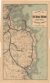
 1888 Old Colony Railroad Cape Cod map.png 3,500 × 2,436; 18.69 MB
-
 1888 Old Colony Railroad South Shore map.png 2,384 × 3,975; 20.2 MB
-
 Atlas of Norfolk County, 1888, Plate 9.png 3,500 × 2,367; 9.41 MB
-
 Foxborough, Massachusetts (2673643613).jpg 2,000 × 1,640; 3.26 MB
-
 Franklin, Massachusetts (2674961187).jpg 2,000 × 1,298; 2.58 MB
-

-
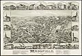 Mansfield, Massachusetts (2673720087).jpg 2,000 × 1,364; 2.49 MB
-
 Map of Massachusetts (3120225899).jpg 2,000 × 1,412; 2.73 MB
-
 Milford, Massachusetts (2673689785).jpg 2,000 × 1,480; 2.92 MB
-
 Milford, Massachusetts, 1888. LOC 2015588504.jpg 10,754 × 7,713; 16.1 MB
-
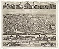 Newton Upper Falls, Massachusetts, 1888 (2674965797).jpg 2,000 × 1,661; 3.1 MB
-
 Sanborn Hudson MA 1888 key map.png 2,728 × 3,184; 143 KB
-
 South Easton, Massachusetts (2674488302).jpg 2,000 × 1,662; 3.02 MB
-
 Topographic map of Massachusetts and Rhode Island (8345527561).jpg 800 × 509; 82 KB
-
 View of Hopedale, Massachusetts (2673661367).jpg 2,000 × 1,582; 2.87 MB
-
 Westborough, Massachusetts, 1888 (2674698544).jpg 2,000 × 1,374; 2.73 MB
-
 Westborough, Massachusetts, 1888. LOC 2010589384.jpg 10,323 × 7,459; 14.12 MB
-
 Wrentham, Massachusetts, 1888 (2673887935).jpg 2,000 × 1,577; 2.56 MB


.jpg)
.jpg)
.jpg)
.jpg)
.jpg)
.jpg)

.jpg)

.jpg)
.jpg)
.jpg)
.jpg)

.jpg)