Category:1886 maps of Virginia
Jump to navigation
Jump to search
States of the United States: California · Connecticut · Georgia · Hawaii · Illinois · Indiana · Iowa · Kansas · Kentucky · Louisiana · Maine · Maryland · Massachusetts · Michigan · Mississippi · Missouri · Montana · New Hampshire · New Jersey · New Mexico · New York · Ohio · Pennsylvania · Rhode Island · South Carolina · South Dakota · Tennessee · Texas · Utah · Vermont · Virginia · West Virginia · Wisconsin · Wyoming
Puerto Rico
Puerto Rico
| 1882 1883 1884 1885 1886 1887 1888 → |
Subcategories
This category has the following 7 subcategories, out of 7 total.
S
Media in category "1886 maps of Virginia"
The following 51 files are in this category, out of 51 total.
-
 (Maps illustrating the Gettysburg campaign. June 3-July 3, 1863). LOC 99448796.jpg 11,880 × 15,076; 15.35 MB
-
 (Maps illustrating the Gettysburg campaign. June 3-July 3, 1863). LOC 99448796.tif 11,880 × 15,076; 512.42 MB
-

-

-
 Map of Augusta Co., Virginia, 1738-1770 LOC 99446927.jpg 2,302 × 1,372; 504 KB
-
 Map of Augusta Co., Virginia, 1738-1770 LOC 99446927.tif 2,302 × 1,372; 9.04 MB
-
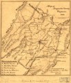
 Map of Augusta County, Virginia, 1886 LOC 99446932.jpg 3,206 × 3,721; 1.67 MB
-
 Map of Augusta County, Virginia, 1886 LOC 99446932.tif 3,206 × 3,721; 34.13 MB
-
 Map of Augusta County, Virginia, 1886.tif 3,206 × 3,441; 31.74 MB
-
 Map of Hanover County, Virginia LOC 2003683403.jpg 6,507 × 5,502; 3.74 MB
-
 Map of Hanover County, Virginia LOC 2003683403.tif 6,507 × 5,502; 102.43 MB
-
 Map of part of Augusta County, Colony of Virginia, 1755-1760 LOC 99446928.jpg 2,470 × 1,947; 790 KB
-
 Map of part of Augusta County, Colony of Virginia, 1755-1760 LOC 99446928.tif 2,470 × 1,947; 13.76 MB
-

-

-
 Map showing the location of Mount Rogers, Augusta Co., Va. LOC 2005625213.jpg 3,136 × 2,429; 1.04 MB
-
 Map showing the location of Mount Rogers, Augusta Co., Va. LOC 2005625213.tif 3,136 × 2,429; 21.79 MB
-

-

-
 Personal Memoirs of Ulysses S. Grant Volume II (page 183 crop).jpg 1,365 × 2,258; 995 KB
-
 Personal Memoirs of Ulysses S. Grant Volume II (page 213 crop).jpg 1,351 × 2,232; 645 KB
-
 Personal Memoirs of Ulysses S. Grant Volume II (page 265 crop).jpg 1,446 × 1,797; 891 KB
-
 Personal Memoirs of Ulysses S. Grant Volume II (page 479 crop).jpg 2,256 × 1,371; 825 KB
-

-

-

-

-

-
 Relative positions of forces at sunset, Aug. 28, 1862. (2nd Manassas Campaign). LOC 99439207.tif 2,479 × 2,423; 17.19 MB
-

-

-

-

-

-

-

-
 Sanborn Fire Insurance Map from Lexington, Independent Cities, Virginia. LOC sanborn09037 001.tif 6,450 × 7,650; 141.17 MB
-
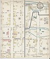 Sanborn Fire Insurance Map from Marion, Smith County, Virginia. LOC sanborn09043 001.jpg 6,450 × 7,650; 3.96 MB
-
 Sanborn Fire Insurance Map from Marion, Smith County, Virginia. LOC sanborn09043 001.tif 6,450 × 7,650; 141.17 MB
-

-
 Sanborn Fire Insurance Map from Salem, Independent Cities, Virginia. LOC sanborn09068 001.tif 6,450 × 7,650; 141.17 MB
-

-

-

-
 Sanborn Fire Insurance Map from Waynesboro, Independent Cities, Virginia. LOC sanborn09089 001.tif 6,450 × 7,650; 141.17 MB
-
 Second battle of Bull Run. Position of troops at sunset, Aug. 29, 1862. LOC 99439212.jpg 1,627 × 2,527; 825 KB
-
 Second battle of Bull Run. Position of troops at sunset, Aug. 29, 1862. LOC 99439212.tif 1,627 × 2,527; 11.76 MB
-
 Second battle of Bull Run. Positions of troops Aug. 30, 1862. LOC 99439217.jpg 1,598 × 2,383; 765 KB
-
 Second battle of Bull Run. Positions of troops Aug. 30, 1862. LOC 99439217.tif 1,598 × 2,383; 10.9 MB
-

-
 Topographic map of the battle-field of Port Republic, Virginia, June 9, 1862 LOC 99446761.tif 3,090 × 2,984; 26.38 MB
._LOC_99448796.jpg)


.jpg)
.jpg)
.jpg)
.jpg)
._LOC_99439197.jpg)
._LOC_99439202.jpg)
._LOC_99439207.jpg)


,_Virginia._LOC_sanborn09019_001.jpg)


