Category:1886 maps of Australia
Jump to navigation
Jump to search
Subcategories
This category has only the following subcategory.
1
- 1886 maps of New South Wales (86 F)
Media in category "1886 maps of Australia"
The following 13 files are in this category, out of 13 total.
-

-
 Ashburnham County (NSW) map of 1886.png 604 × 395; 431 KB
-
 Dowling County Map of 1886.png 598 × 434; 466 KB
-
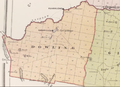
 Map of Denison County (NSW) in 1886.png 593 × 425; 390 KB
-
 Map of Forbes County in 1886.png 614 × 433; 500 KB
-
 Map of Gunderbooka County (NSW) in 1886.png 319 × 264; 138 KB
-

-
 Murchison County (NSW) Map 1886.png 592 × 433; 443 KB
-
 Roxburgh Map (NSW) from John Sands Atlas of Australiasia1886.png 376 × 420; 264 KB
-
 Carapook, county of Dundas - (located in state of Victoria). LOC 2008624021.jpg 7,428 × 10,362; 8.94 MB
-
 Carapook, county of Dundas - (located in state of Victoria). LOC 2008624021.tif 7,428 × 10,362; 220.21 MB
-
 Hawksburn Estate map.jpg 1,600 × 1,134; 708 KB
-

.jpg)
_map_of_1886.png)

_in_1886.png)

_in_1886.png)
_Australia_in_1886_showing_location_of_Parishes.png)
_Map_1886.png)
_from_John_Sands_Atlas_of_Australiasia1886.png)
._LOC_2008624021.jpg)

..._-_btv1b53025345k.jpg)