Category:1885 maps of France
Jump to navigation
Jump to search
Countries of Europe: Azerbaijan‡ · France‡ · Georgia‡ · Germany · Italy · Norway · Russia‡ · Spain‡ · Sweden · Turkey‡ · United Kingdom
‡: partly located in Europe
‡: partly located in Europe
Subcategories
This category has only the following subcategory.
1
Media in category "1885 maps of France"
The following 14 files are in this category, out of 14 total.
-
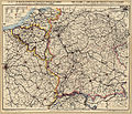 F. Müllhaupt's Militarische & Verkehrs-Karte der Deutsch-Französischen Grenze...jpg 8,150 × 6,978; 75.1 MB
-

-
 2fi3749 Projet d'octroi au Mail - Rennes.jpg 4,961 × 4,192; 1,011 KB
-
 Carte de la commune de Molesmes (Yonne) - 1885.jpg 6,435 × 7,529; 6.81 MB
-
 Chantilly en 1885 - btv1b8443129x.jpg 8,592 × 5,219; 5.16 MB
-
 France villes - par P. Vidal Lablache... - btv1b52514234t (1 of 2).jpg 18,197 × 16,028; 63.6 MB
-
 France villes - par P. Vidal Lablache... - btv1b52514234t (2 of 2).jpg 18,185 × 16,129; 58.8 MB
-
 France- départements - par P. Vidal-Lablache... - btv1b52505592k (1 of 2).jpg 13,922 × 12,104; 39.53 MB
-
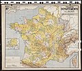 France- départements - par P. Vidal-Lablache... - btv1b52505592k (2 of 2).jpg 13,962 × 12,158; 37.78 MB
-
 Géographie - Toponymie liée à la famille du Buat.jpg 882 × 860; 177 KB
-

-
 Railway map of France - 33 - 1885 - fr - small.svg 1,273 × 879; 6.87 MB
-
 Railway map of France - 87 - 1885 - fr - small.svg 564 × 1,031; 4.82 MB
-
 Sonnet Nouvelle carte complete illustree 06301312.jpg 4,968 × 3,808; 14.09 MB

%27_(11180657134).jpg)

_-_1885.jpg)

.jpg)
.jpg)
.jpg)
.jpg)


