Category:1880s maps of the British Empire
Jump to navigation
Jump to search
Subcategories
This category has the following 4 subcategories, out of 4 total.
Media in category "1880s maps of the British Empire"
The following 5 files are in this category, out of 5 total.
-
 European territorial claims on the coasts of the Red Sea 1885.jpg 8,016 × 3,633; 23.98 MB
-
 European territorial claims on the coasts of the Red Sea 1885.tif 8,016 × 3,633; 27.9 MB
-

-
 Map of Falkland Islands and the Straits of Magellan (1888).jpg 1,235 × 1,953; 1.4 MB
-
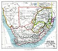 SouthAfrica1885.jpg 3,336 × 2,884; 4.95 MB

%27.jpg)
.jpg)
