Category:1870s maps of the whole Middle East by John Bartholomew
Jump to navigation
Jump to search
Media in category "1870s maps of the whole Middle East by John Bartholomew"
The following 8 files are in this category, out of 8 total.
-
 Turkey in Asia 1871 by John Bartholomew.jpg 7,466 × 10,579; 14.29 MB
-

-

-
 Turkey in Asia, Persia, Arabia, Egypt and Nile Countries 1879 Atlas map by John Bartholomew.jpg 10,077 × 13,751; 23.5 MB
-
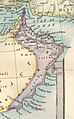
 Oman 1873 map (cropped from original atlas page).jpg 628 × 973; 293 KB
-
 Near East 1879 Atlas Map by John Bartholomew (cropped).jpeg 6,430 × 5,622; 6.97 MB
-
 Oman 1879 map (cropped from original atlas page).jpg 1,949 × 3,132; 1.08 MB
-
 Abyssinia, Shoa, Harar (1873).jpg 1,200 × 762; 449 KB

.jpg)


.jpg)
.jpeg)
.jpg)
.jpg)