Category:1863 maps of South Carolina
Jump to navigation
Jump to search
1863 maps of South Carolina
Media in category "1863 maps of South Carolina"
The following 22 files are in this category, out of 22 total.
-
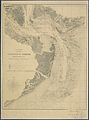
 Charleston and its defences. LOC 99448819.jpg 3,085 × 3,749; 1.94 MB
-
 Charleston and its defences. LOC 99448819.tif 3,085 × 3,749; 33.09 MB
-

-

-

-

-
 Charleston Harbor and its approaches showing the positions of the Rebel batteries LOC lva0000206.tif 6,261 × 7,650; 137.03 MB
-
-

-

-

-

-
 Charleston Harbor and its approaches showing the positions of the Rebel batteries. LOC 99448828.tif 6,181 × 7,970; 140.94 MB
-

-
 Charleston Harbor and its approaches showing the positions of the Rebel batteries. LOC 99448829.tif 8,494 × 8,330; 202.43 MB
-
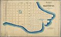
 Charleston Harbor and its approaches. 1863.jpg 1,061 × 1,285; 75 KB
-
 Christ Church Parish, So. Ca. - (Charleston District) LOC 2006636708.jpg 5,883 × 4,873; 2.84 MB
-
 Christ Church Parish, So. Ca. - (Charleston District) LOC 2006636708.tif 5,883 × 4,873; 82.02 MB
-

-
-
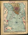
 SiegeCharlestonMap.jpg 1,577 × 1,955; 509 KB
-
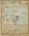
 The Rebel defences of Charleston Harbor S.C., August 1863 LOC gvhs01.vhs00155.tif 1,755 × 2,188; 10.99 MB

.jpg)
.jpg)
.jpg)


_LOC_2006636708.jpg)


