Category:1861 maps of Georgia (U.S. state)
Jump to navigation
Jump to search
States of the United States: California · Delaware · Florida · Georgia · Illinois · Iowa · Louisiana · Maryland · Massachusetts · Michigan · Nevada · North Carolina · Ohio · South Carolina · Texas · Utah · Virginia · West Virginia · Wisconsin – Washington, D.C.
| 1861 1863 1864 1865 1868 |
Media in category "1861 maps of Georgia (U.S. state)"
The following 7 files are in this category, out of 7 total.
-

-
 Birds eye view of Florida and part of Georgia and Alabama LOC 99447266.jpg 9,420 × 6,671; 8.2 MB
-

-

-
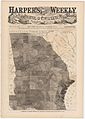 Harper's Georgia Slavery Map 1861 Cornell CUL PJM 1061 01.jpg 6,934 × 9,730; 15.53 MB
-

-


