Category:1860s maps of Pakistan
Jump to navigation
Jump to search
Countries of Asia: Afghanistan · Armenia‡ · Azerbaijan‡ · People's Republic of China · Cyprus‡ · Egypt‡ · Georgia‡ · India · Indonesia‡ · Iran · Iraq · Japan · Lebanon · Oman · Pakistan · Philippines · Russia‡ · Syria · Turkey‡ · Turkmenistan · Uzbekistan · Yemen
Limited recognition: Abkhazia‡ · Taiwan · State of Palestine
‡: partly located in Asia
Limited recognition: Abkhazia‡ · Taiwan · State of Palestine
‡: partly located in Asia
Subcategories
This category has the following 2 subcategories, out of 2 total.
Media in category "1860s maps of Pakistan"
The following 10 files are in this category, out of 10 total.
-

-
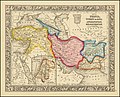 Map of Persia, Turkey in Asia, Afghanistan, Beloochistan.jpg 8,815 × 7,143; 15.63 MB
-
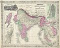 1864 Johnson's Map of India (Hindostan or British India) - Geographicus - India-j-64.jpg 2,500 × 1,990; 1.63 MB
-
 Stein, Christ. Gottfr. Dan.West-Asien. 1865 LA.jpg 1,967 × 1,251; 455 KB
-
 Stein, Christ. Gottfr. Dan.West-Asien. 1865 LI.jpg 1,413 × 3,056; 806 KB
-
 Stein, Christ. Gottfr. Dan.West-Asien. 1865 LJ.jpg 1,413 × 2,019; 517 KB
-
 Stein, Christ. Gottfr. Dan.West-Asien. 1865 LK.jpg 905 × 574; 108 KB
-
 Südwest-Asien Besitzungen Europäischer Mächte 1866.tif 6,404 × 5,156; 94.49 MB
-

-
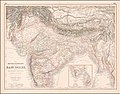 Ca. 1860 map of India and neighbouring countries.jpg 13,565 × 10,575; 30.69 MB


_-_Geographicus_-_India-j-64.jpg)


_-_Geographicus_-_Arabia-johnson-1866.jpg)
