Category:1860s maps of Ohio
Jump to navigation
Jump to search
States of the United States: Alabama · Alaska · Arizona · Arkansas · California · Colorado · Connecticut · Delaware · Florida · Georgia · Idaho · Illinois · Indiana · Iowa · Kansas · Kentucky · Louisiana · Maine · Maryland · Massachusetts · Michigan · Minnesota · Mississippi · Missouri · Montana · Nebraska · Nevada · New Hampshire · New Jersey · New Mexico · New York · North Carolina · North Dakota · Ohio · Oklahoma · Oregon · Pennsylvania · Rhode Island · South Carolina · South Dakota · Tennessee · Texas · Utah · Vermont · Virginia · Washington · West Virginia · Wisconsin · Wyoming – Washington, D.C.
Puerto Rico
Puerto Rico
Subcategories
This category has the following 6 subcategories, out of 6 total.
- 1860 maps of Ohio (11 F)
- 1861 maps of Ohio (9 F)
- 1862 maps of Ohio (6 F)
- 1863 maps of Ohio (1 F)
- 1864 maps of Ohio (5 F)
- 1866 maps of Ohio (2 F)
Media in category "1860s maps of Ohio"
The following 5 files are in this category, out of 5 total.
-
-
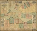
 Map of Hancock Co., Ohio LOC 2012591120.jpg 16,441 × 16,214; 34.59 MB
-
 Map of Monroe County, Ohio LOC 2012592380.jpg 17,833 × 14,450; 33.98 MB
-
 Map of Shelby Co., Ohio LOC 2012592391.jpg 15,070 × 13,064; 25.92 MB
-


