Category:1856 maps of the United States
Jump to navigation
Jump to search
Countries of North America: Canada · Nicaragua · United States of America‡
‡: partly located in North America
‡: partly located in North America
States of the United States: California · Florida · Illinois · Iowa · Maryland · Massachusetts · Michigan · Missouri · New York · Ohio · Pennsylvania · Texas · Vermont – Washington, D.C.
| ← 1850 1851 1852 1853 1854 1855 1856 1857 1858 1859 → |
Subcategories
This category has the following 16 subcategories, out of 16 total.
C
- 1856 maps of California (3 F)
D
F
- 1856 maps of Florida (5 F)
I
- 1856 maps of Illinois (1 F)
- 1856 maps of Iowa (2 F)
M
- 1856 maps of Maryland (2 F)
- 1856 maps of Massachusetts (21 F)
- 1856 maps of Michigan (1 F)
- 1856 maps of Missouri (1 F)
N
- 1856 maps of New York (state) (19 F)
O
- 1856 maps of Ohio (19 F)
P
T
- 1856 maps of Texas (3 F)
V
- 1856 maps of Vermont (6 F)
Media in category "1856 maps of the United States"
The following 26 files are in this category, out of 26 total.
-

-
-
-
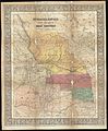
 A New map of the great west (NBY 19590).jpg 3,600 × 2,193; 1.45 MB
-
 Ensign, Bridgman & Fanning's rail road map of the Eastern States. LOC 98688360.jpg 7,502 × 5,203; 10.86 MB
-
 Ensign, Bridgman & Fanning's rail road map of the Eastern States. LOC 98688360.tif 7,502 × 5,203; 111.67 MB
-

-

-
-
 Kansas & Nebraska. LOC 2012583327.tif 6,770 × 6,843; 132.54 MB
-

-

-

-
 Map of U.S. free and slave states, 1850s.jpg 2,237 × 1,995; 1.26 MB
-
 Monteith's map of United States, 1856.jpg 565 × 354; 57 KB
-
 National political map of the United States. LOC 2012586609.jpg 9,474 × 11,656; 18.75 MB
-
 National political map of the United States. LOC 2012586609.tif 9,474 × 11,656; 315.94 MB
-

-
 Preliminary chart of the sea coast of part of Alabama and Mississippi (NYPL b19561224-5247811).tiff 10,328 × 7,760, 2 pages; 229.57 MB
-
 Neueste Post-u. Eisenbahn Karte der Vereinigten Staaten von Nord-America (NYPL b20643921-5578063).tiff 10,328 × 7,760, 2 pages; 229.61 MB
-
 Rail road map of the United States, showing the depots & stations. LOC 98688322.tif 10,471 × 9,802; 293.65 MB
-
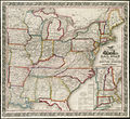
 Reynolds's Political Map of the United States 1856.jpg 7,813 × 7,090; 19.76 MB
-

-

-
 Saint Landry St Landre Parish 1856 from Colton's Louisiana LOC 2010592397.jpg 1,006 × 1,006; 453 KB
-
 Le globe - atlas classique universel de geographie 1856 (78258033).jpg 10,096 × 6,319; 11.99 MB

.jpg)
.jpg)


.jpg)

.jpg)


.jpg)


.jpg)