Category:1848 U.S. presidential election maps by state
Jump to navigation
Jump to search
Media in category "1848 U.S. presidential election maps by state"
The following 18 files are in this category, out of 18 total.
-
 Alabama Presidential Election Results 1848.svg 800 × 1,254; 690 KB
-
 Arkansas Presidential Election Results 1848.svg 759 × 665; 587 KB
-
 Connecticut Presidential Election Results 1848.svg 810 × 595; 30 KB
-
 Delaware Presidential Election Results 1848.svg 744 × 744; 19 KB
-
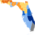
 The 1848 Presidential election in Florida by county.png 461 × 430; 35 KB
-
 Florida Presidential Election Results 1848.svg 800 × 776; 1.81 MB
-
 Indiana Presidential Election Results 1848.svg 744 × 744; 209 KB
-
 Kentucky Presidential Election Results 1848.svg 744 × 341; 564 KB
-
 Maryland Presidential Election Results 1848.svg 800 × 420; 1.09 MB
-
 Massachusetts Presidential Election Results 1848.svg 810 × 502; 27 KB
-
 Michigan Presidential Election Results 1848.svg 800 × 937; 1.31 MB
-
 New Hampshire Presidential Election Results 1848.svg 810 × 810; 403 KB
-
 New Jersey Presidential Election Results 1848.svg 810 × 810; 31 KB
-
 New York Presidential Election Results 1848.svg 800 × 600; 1.1 MB
-
 Rhode Island Presidential Election Results 1848.svg 810 × 810; 13 KB
-
 Texas Presidential Election Results 1848.svg 800 × 1,111; 3.62 MB
-
 Vermont Presidential Election Results 1848.svg 810 × 810; 18 KB
-
 Wisconsin Presidential Election Results 1848.svg 245 × 262; 595 KB


