Category:1840s maps of Chechnya
Jump to navigation
Jump to search
Federal subjects of the Russian Federation:
Republics: Chechnya · Dagestan ·Krais:
Oblasts:
Federal cities:
Autonomous oblast:
Autonomous okrugs:
Media in category "1840s maps of Chechnya"
The following 13 files are in this category, out of 13 total.
-
 KistiKarta.jpg 1,656 × 1,080; 366 KB
-

-
-

-
-

-

-

-
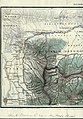
 Karta Caucasus. 1847 year.png 1,228 × 801; 1.96 MB
-
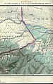
 Карта Владикавказского Военного Округа и Малой Чечни.jpg 5,213 × 4,276; 28.16 MB
-
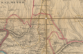
 Карта Восточного Кавказа 1841 год.jpg 2,681 × 1,876; 1.09 MB
-
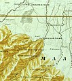
 Карта Чечни 19 века (1 часть).tif 5,213 × 4,276; 63.78 MB
-
 Тумси-Юрт.jpg 503 × 567; 258 KB

_%D0%A4._386._%D0%9E%D0%BF._1._%D0%94._2863_(1).jpg)
_%D0%A4._386._%D0%9E%D0%BF._1._%D0%94._2863_(2).jpg)
_%D0%A4._386._%D0%9E%D0%BF._1._%D0%94._2863_(3).jpg)
_%D0%A4._386._%D0%9E%D0%BF._1._%D0%94._2863_(4).jpg)


