Category:1840s maps of Boston
Jump to navigation
Jump to search
Subcategories
This category has the following 2 subcategories, out of 2 total.
Media in category "1840s maps of Boston"
The following 48 files are in this category, out of 48 total.
-

-
 1841 Cornhill map Boynton Boston BPL10938.png 806 × 714; 1.07 MB
-
 1842 SouthEnd Boston byBoynton map BPL10940 detail.png 805 × 713; 1.09 MB
-
 1842 USHotel Boston.png 687 × 720; 863 KB
-
 1842 WestEnd Boston map byBoynton detail BPL 10940.png 761 × 714; 975 KB
-
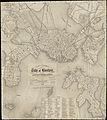
 1844 Plan of the City of Boston, by Samuel N. Dickinson and George W. Boynton.jpg 6,725 × 5,951; 80.9 MB
-
 1844 WinterSt map Boston BPL 10941 detail.png 696 × 707; 967 KB
-
 1846 jail Boston map byGGSmith detail BPL 10581.png 815 × 715; 866 KB
-
 1846 MerrimacSt Boston map byGGSmith detail BPL 10581.png 1,058 × 745; 1.53 MB
-
 1846 National Theatre Boston map byGGSmith detail BPL 10581.png 815 × 715; 904 KB
-
 1846 NationalTheatre Boston map byGGSmith detail BPL 10581.png 815 × 715; 1.04 MB
-
 Boston Harbour (2674920749).jpg 2,000 × 1,527; 1.83 MB
-

-
 1848 railroad map of the Boston area (14738224386).jpg 3,994 × 3,378; 2.46 MB
-

-

-

-
-
 Boston 1842 BowdoinSquare area.jpg 255 × 269; 102 KB
-
 Boston 1842 PembertonHill area.jpg 245 × 183; 65 KB
-
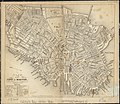
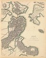
 Boston 1842.jpg 1,005 × 1,226; 341 KB
-
 Boston map 1842 HollisStreet area.jpg 280 × 317; 109 KB
-
 Bulfinch Triangle detail of 1844 Boynton Plan of the City of Boston.JPG 1,181 × 717; 257 KB
-

-

-
 Map of the city of Roxbury (2674666167).jpg 2,000 × 1,524; 2.62 MB
-

-
 Map of the town of Roxbury, surveyed by order of the town authorities (7537848972).jpg 2,000 × 1,571; 2.57 MB
-
 Plan of an estate in High St. to be sold at auction Sat. (2675383668).jpg 1,370 × 2,000; 1.46 MB
-

-
 Plan of Boston comprising a part of Charlestown and Cambridge (2674674844).jpg 1,864 × 2,000; 3.44 MB
-
 Plan of city lands and streets s.w. of Dover St. (3887216996).jpg 2,000 × 1,747; 2.71 MB
-
 Plan of East Boston (2675490706).jpg 2,000 × 1,295; 2.29 MB
-

-

-
 Plan of lots on O Street, South Boston (9472186893).jpg 799 × 490; 48 KB
-
 Plan of real estate on Pearl Street, Boston (2675453884).jpg 1,484 × 2,000; 2.28 MB
-
-
 Plan of the city of Boston (2674416495).jpg 2,000 × 1,739; 3.57 MB
-
 Plan of the city of Boston (2675236446).jpg 1,773 × 2,000; 3.07 MB
-
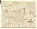 Plan of the city of Charlestown (3121053626).jpg 2,000 × 1,561; 2.69 MB
-
 Plan of the Inner Harbor of Boston (2674925123).jpg 1,575 × 2,000; 1.78 MB
-

-
 Plan showing the proposed entrance into Boston of the Fitchburg Rail Road. LOC 98688657.tif 8,556 × 5,358; 131.16 MB
-
 The history of Charlestown, Massachusetts (1845) (14596669860).jpg 2,560 × 1,350; 440 KB
-
 Warren Bridge - Charlestown-Boston - 1.jpg 5,090 × 6,364; 13.97 MB
-
 Waterfront detail Boston map 1842.jpg 377 × 158; 72 KB
-

.jpg)


.jpg)

.jpg)
._Committee_on_Internal_Health,_from_the_Digital_Commonwealth_-_commonwealth_8336hc331.jpg)
%27_(11224858314).jpg)
.jpg)
.jpg)


.jpg)
.jpg)
.jpg)
.jpg)
.jpg)
.jpg)
.jpg)
.jpg)
.jpg)
.jpg)

.jpg)
.jpg)
.jpg)
.jpg)
.jpg)
.jpg)
.jpg)

_(14596669860).jpg)


.jpg)