Category:1840 maps of the United States
Jump to navigation
Jump to search
Subcategories
This category has the following 4 subcategories, out of 4 total.
Media in category "1840 maps of the United States"
The following 26 files are in this category, out of 26 total.
-

-

-

-

-
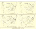 EB9 United States - historical maps (bottom).jpg 2,501 × 2,000; 942 KB
-
-
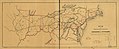
 Map from "Letters and notes on the manners..." Vol II Wellcome L0073493.jpg 3,471 × 5,400; 4.98 MB
-

-

-

-

-
-

-
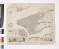
 Map of the villages of Astoria (late Hallett's Cove) & Ravenswood, Long Island. LOC 2004625798.tif 8,378 × 6,726; 161.22 MB
-

-

-
 New York. NYPL434683.tiff 6,300 × 5,228; 94.23 MB
-
 New York. NYPL434684.tiff 6,328 × 5,700; 64.72 MB
-

-

-

-

-

-

-

-

%27_(11019472894).jpg)

.jpg)


_%26_Ravenswood,_Long_Island._LOC_2004625798.jpg)

.jpg)
.jpg)

.jpg)
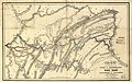
_with_proposed_extensions_to_Cleveland,_Cincinnati_and_St._Louis,_in_connexion_(sic)_with_the_public_works_of_Pennsylvania,_Ohio,_Indiana_LOC_98688348.jpg)