Category:1838 maps of Europe
Jump to navigation
Jump to search
Temperate regions: North America · South America · Africa · Europe · Asia · Oceania – Polar regions: – Other regions:
English: 1838 maps of Europe
Español: Mapas de Europa en 1838
Suomi: Euroopan kartat vuodelta 1838
Română: Hărți ale Europei din 1838
Subcategories
This category has the following 7 subcategories, out of 7 total.
.
F
G
I
- 1838 maps of Italy (2 F)
N
- 1838 maps of Norway (4 F)
O
- Oberreit, Sect. Leipzig, 1836–39 (54 F)
S
- 1838 maps of Spain (7 F)
Media in category "1838 maps of Europe"
The following 11 files are in this category, out of 11 total.
-
 Black Sea (14775361427) (cropped).jpg 590 × 335; 322 KB
-
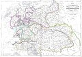 Carte Allemagne 1838.jpg 4,500 × 3,149; 8.28 MB
-
 Dänemark Karte 1838 Friedrich Wilhelm Streit.tif 5,184 × 6,032; 63.85 MB
-
 Dänemark Karte 1841 Friedrich Wilhelm Streit.jpg 3,248 × 3,807; 2.54 MB
-
 Dänemark Karte 1841 Friedrich Wilhelm Streit.tif 3,262 × 3,807; 34.73 MB
-
 Europe (14775361427).jpg 2,000 × 1,657; 4.24 MB
-

-

-

-
 Plan af Gamlakarleby utgifven 1838 af C. W. Gyldén.png 3,469 × 2,618; 9.34 MB
-
 Venice 1838 map.jpg 12,033 × 7,053; 17.72 MB
_(cropped).jpg)


.jpg)


