Category:1829 maps of Massachusetts
Jump to navigation
Jump to search
States of the United States: Florida · Indiana · Louisiana · Massachusetts · New Jersey · New York · Pennsylvania · Rhode Island
| ← 1820 1824 1826 1827 1828 1829 |
Media in category "1829 maps of Massachusetts"
The following 16 files are in this category, out of 16 total.
-
 1829 BedfordSt Boston map byStimpson BPL12254 detail.png 803 × 711; 1.14 MB
-
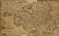 1829 Boston map byCharlesStimpson BPL 12254.png 982 × 607; 1.03 MB
-
 1829 BrattleSt Boston Stimpson BPL12254.png 809 × 713; 1.14 MB
-
 1829 ElmSt map Boston BPL12254.png 800 × 712; 1.12 MB
-
 1829 ExchangeSq Boston map Stimpson.png 441 × 392; 376 KB
-
 1829 HanoverSt Boston Stimpson BPL12254.png 806 × 712; 1.17 MB
-
 1829 Leverett St jail Boston map BPL 12254.png 633 × 618; 599 KB
-
 1829 WashingtonSt Boston Stimpson BPL12254.png 962 × 578; 1.03 MB
-
 BoylstonSt Boston1829 Stimpson.png 611 × 624; 776 KB
-
 CourtSt Boston1829 Stimpson.png 800 × 711; 1.18 MB
-
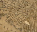 Financial Boston1829 Stimpson.png 809 × 711; 1.17 MB
-
 Map of Boston and its vicinity from actual survey (2674734696).jpg 2,000 × 1,680; 3.21 MB
-
 Map of Lynn and Saugus - settled in 1629 LOC 2011589328.jpg 6,086 × 5,331; 4.05 MB
-
 Map of Lynn and Saugus - settled in 1629 LOC 2011589328.tif 6,086 × 5,331; 92.82 MB
-
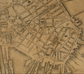 NorthEnd Boston1829 Stimpson.png 812 × 716; 1.2 MB
-
 WestEnd Boston1829 Stimpson.png 633 × 618; 598 KB


.jpg)


