Category:1814 maps of the United States
Jump to navigation
Jump to search
States of the United States: Iowa · Louisiana · Maryland · Massachusetts · Missouri · Ohio · Pennsylvania
Subcategories
This category has the following 8 subcategories, out of 8 total.
I
- 1814 maps of Iowa (2 F)
L
- 1814 maps of Louisiana (7 F)
M
- 1814 maps of Maryland (1 F)
- 1814 maps of Missouri (1 F)
O
- 1814 maps of Ohio (7 F)
P
- 1814 maps of Pennsylvania (2 F)
Media in category "1814 maps of the United States"
The following 18 files are in this category, out of 18 total.
-
 1814 Thomson Map of North America - Geographicus - NorthAmerica-thomson-1814.jpg 4,000 × 3,343; 3.3 MB
-
 1814 Thomson Map of Texas, Mexico ^ Louisiana - Geographicus - SpanishNorthAmer-t-1814.jpg 4,000 × 3,325; 2.98 MB
-
 Map of the United States of America (NYPL b15376646-433676).tiff 6,299 × 5,248; 94.6 MB
-
 Byu-archives map lewis clark columbia east 1814.jpg 640 × 480; 109 KB
-
 Fort Hampton map.jpg 1,295 × 953; 209 KB
-
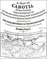 Map of Cabotia.jpg 500 × 620; 59 KB
-
 Missouri territory formerly Louisiana. LOC 2001620466.jpg 4,408 × 3,962; 2.46 MB
-
 Missouri territory formerly Louisiana. LOC 2001620466.tif 4,408 × 3,962; 49.97 MB
-
 Missouri territory formerly Louisiana. LOC 2001620467.jpg 4,290 × 3,853; 2.52 MB
-
 Missouri territory formerly Louisiana. LOC 2001620467.tif 4,290 × 3,853; 47.29 MB
-
 NewYork1814.pdf 3,181 × 2,543; 22.5 MB
-
 The State of Tennessee (NYPL b15376638-1403996).jpg 6,299 × 5,248; 6.4 MB
-
 The State of Georgia. NYPL1404005.tiff 5,248 × 6,299; 94.6 MB
-
 The upper territories of the United States - DPLA - 5c9c283cd74aeb6314a5faeba3863d1f.jpg 5,086 × 6,520; 3.32 MB
-
 The upper territories of the United States. LOC 99466710.jpg 4,412 × 5,706; 3.6 MB
-
 The upper territories of the United States. LOC 99466710.tif 4,412 × 5,706; 72.03 MB
-
 The Upper territories of the United States. NYPL1404010.tiff 5,248 × 6,299; 94.6 MB
-


.jpg)


.jpg)