Category:1806 maps of Massachusetts
Jump to navigation
Jump to search
States of the United States: Kentucky · Massachusetts
| ← 1801 1803 1805 1806 1807 1809 → |
Media in category "1806 maps of Massachusetts"
The following 9 files are in this category, out of 9 total.
-
 1806 Boston map byRPhillips.png 807 × 714; 1.11 MB
-
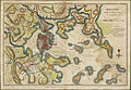
 1806 Boston map Wayne BPL10640.png 680 × 659; 996 KB
-
 1806 Cornhill Boston byNorman detail BPL10103.png 806 × 715; 974 KB
-
 1806 NorthEnd Boston byNorman detail BPL10103.png 814 × 715; 995 KB
-
 1806 PearlSt Boston map byWilliamNorman.png 808 × 715; 1.08 MB
-
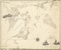 1806 Salem Massachusetts map byBowditch BPL 10920.png 893 × 730; 770 KB
-
 Boston with its environs (2673923259).jpg 2,000 × 1,376; 3.27 MB
-
 Eastie1806.jpg 1,179 × 845; 1.24 MB
-
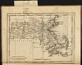 Massachusetts (3046241596).jpg 2,000 × 1,576; 3.12 MB


.jpg)

.jpg)