Category:1800 maps of the United States
Jump to navigation
Jump to search
Subcategories
This category has the following 4 subcategories, out of 4 total.
Media in category "1800 maps of the United States"
The following 36 files are in this category, out of 36 total.
-

-

-
-
 A map of part of the N.W. territory of the United States (3045319449).jpg 2,000 × 1,577; 2.8 MB
-
 A map of the Tennassee state formerly part of North Carolina (3045318235).jpg 2,000 × 1,527; 2.5 MB
-
 AMH-8632-NA Map of Nieuw Nederland featuring an inset showing Nieuw Amsterdam.jpg 2,400 × 2,028; 839 KB
-
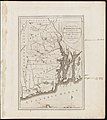
 Connecticut from the best authorities (3046153908).jpg 2,000 × 1,777; 3.2 MB
-
 Costa desde la Mobila asta la Bahía de Sn. Josef. LOC 91680927.jpg 8,721 × 6,378; 3.59 MB
-
 Costa desde la Mobila asta la Bahía de Sn. Josef. LOC 91680927.tif 8,721 × 6,378; 159.14 MB
-
 Delaware, from the best authorities (3045317185).jpg 1,794 × 2,000; 2.99 MB
-

-
 LowsUSAmap 1.jpeg 3,120 × 2,472; 4.48 MB
-
 Manuscript map of Eastern Canada and New England. LOC 2017585986.jpg 3,624 × 2,123; 1.41 MB
-
 Manuscript map of Eastern Canada and New England. LOC 2017585986.tif 3,624 × 2,123; 22.01 MB
-
 Map of Mobile Bay LOC 2007629220.jpg 5,091 × 6,372; 2.79 MB
-
 Map of Mobile Bay LOC 2007629220.tif 5,091 × 6,372; 92.81 MB
-
 Map of New Orleans - NARA - 306381.tif 4,050 × 2,622; 30.38 MB
-
 Map of the district of Maine, Massachusetts, compiled from actual surveys. LOC gm70001634.jpg 11,584 × 16,527; 24.16 MB
-

-
 Millers Falls, Mass. LOC 93683271.jpg 7,264 × 5,440; 7.41 MB
-
 Millers Falls, Mass. LOC 93683271.tif 7,264 × 5,440; 113.06 MB
-
 Map of the southern provinces of the United States (NYPL b15110730-434053).tiff 5,851 × 4,616; 77.28 MB
-
 Map of the northern provinces of the United States (NYPL b15112872-433916).tiff 5,955 × 4,536; 77.29 MB
-

-

-
 The province of Maine, from the best authorities (3046153322).jpg 1,776 × 2,000; 2.73 MB
-
 The state of Maryland, from the best authorities (3046154788).jpg 2,000 × 1,653; 2.91 MB
-
 The state of Massachusetts compiled from the best authorities (3046153520).jpg 2,000 × 1,570; 2.66 MB
-
 The state of New Hampshire compiled chiefly from actual survey (3045315905).jpg 1,433 × 2,000; 2.53 MB
-
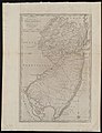 The state of New Jersey, compiled from the most authentic information (3046154166).jpg 1,538 × 2,000; 2.64 MB
-
 The state of North Carolina from the best authorities, &c. (3045317657).jpg 2,000 × 1,571; 2.75 MB
-
-
 The state of South Carolina from the best authorities (3045317817).jpg 2,000 × 1,555; 2.8 MB
-
 The state of Virginia from the best authorities (3045317491).jpg 2,000 × 1,525; 2.68 MB
-
 This map of Kentucke, LOC 73691819.jpg 5,560 × 6,269; 4.49 MB
-
 This map of Kentucke, LOC 73691819.tif 5,560 × 6,269; 99.72 MB
._LOC_2013585063.jpg)
.jpg)
.jpg)
.jpg)

.jpg)

.jpg)
_(14771799954).jpg)


_-_NARA_-_2450016.jpg)


.jpg)
.jpg)
.jpg)
.jpg)
.jpg)
.jpg)
.jpg)
.jpg)
.jpg)
