Category:17th-century maps of Venezuela
Jump to navigation
Jump to search
Media in category "17th-century maps of Venezuela"
The following 43 files are in this category, out of 43 total.
-
 Atlas ou Representation du Monde Universel t. 2. 1633 (110103047).jpg 16,609 × 12,159; 35.98 MB
-
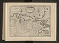
 1635 Blaeu Map Guiana, Venezuela, and El Dorado - Geographicus - Guiana-blaeu-1635.jpg 4,000 × 3,084; 3.51 MB
-

-
 1656 Sanson Map of Guiana, Venezuela, and El Dorado - Geographicus - Guiane-sanson-1656.jpg 4,000 × 3,115; 3.32 MB
-
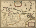
 1672 Coro detail Chart of the West Indies by John Seller BPL 15020.png 1,219 × 593; 1.43 MB
-
 Print, book-illustration, map (BM 1972,U.58.9).jpg 2,500 × 1,657; 968 KB
-

-

-

-

-

-

-
 Golphe de Paria et isles - btv1b53121981m.jpg 7,462 × 5,574; 3.56 MB
-
 Guiana and Amazon Region - 1649.jpg 19,160 × 14,645; 44.39 MB
-
 Mapa de Venezuela (1671).jpg 800 × 645; 373 KB
-
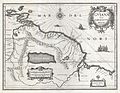
 Mapa de Venezuela 1635.jpg 800 × 617; 252 KB
-
 Mapa de Venezuela.JPG 4,000 × 2,406; 5.59 MB
-

-

-

-

-

-

-

-
 Plan de l'île d'Aves - btv1b53103480b.jpg 2,028 × 1,536; 401 KB
-

-

-

-

-

-

-
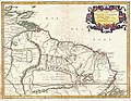
 Venezuela cum parte Australi Novae Andalusiae (8429936185).jpg 800 × 699; 128 KB
-

-
 Venezuela cum parte Australi Novae Andalusiae - btv1b8596473x (1 of 2).jpg 7,904 × 6,082; 8.37 MB
-
 Venezuela cum parte australi Novae Andalusiae - CBT 6621117.jpg 5,544 × 4,278; 6.01 MB
-

-
 Venezuela Together with the Southern Part of New Andalusia WDL220.jpg 5,881 × 4,531; 7.14 MB
-
 Venezuela Together with the Southern Part of New Andalusia WDL220.png 1,325 × 1,024; 2.67 MB
-
 Venezuela with the Southern Part of New Andalusia WDL11337.jpg 5,780 × 4,642; 9.44 MB
-
 Venezuela with the Southern Part of New Andalusia WDL11337.png 1,238 × 1,024; 2.6 MB
-
 Venezuela, cum parte Auftrali Novae Andalausiae. LOC 97683568.jpg 5,904 × 4,560; 4.54 MB
-
 Venezuela, cum parte Auftrali Novae Andalausiae. LOC 97683568.tif 5,904 × 4,560; 77.03 MB
-
 Venezuela, cum parte Australi Novae Andalusiae - btv1b53196851w (3 of 4).jpg 8,661 × 6,427; 8.81 MB
.jpg)

.jpg)


.jpg)
.jpg)


.jpg)


.jpg)
,_RP-P-1896-A-19368-3090.jpg)


.jpg)
_-_btv1b8596474b_(1_of_2).jpg)
.jpg)


.jpg)