Category:17 Barbary Street in Częstochowa
Jump to navigation
Jump to search
| Object location | | View all coordinates using: OpenStreetMap |
|---|
Media in category "17 Barbary Street in Częstochowa"
The following 8 files are in this category, out of 8 total.
-
 Częstochowa - barbary 17 (1).jpg 1,333 × 1,000; 1.51 MB
-
 Częstochowa - barbary 17 (2).jpg 1,333 × 1,000; 1.94 MB
-
 Częstochowa - barbary 17.jpg 1,333 × 1,000; 1.55 MB
-
 Częstochowa budynek Barbary 17 fragment p.jpg 3,288 × 2,220; 2.55 MB
-
 Częstochowa budynek Barbary 17 fragment2 p.jpg 2,124 × 2,453; 2.21 MB
-
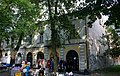 Częstochowa budynek Barbary 17 p.jpg 3,276 × 2,068; 3.81 MB
-
 Częstochowa budynek Barbary 17 p2.jpg 2,035 × 3,306; 2.55 MB
-
 Częstochowa budynek Barbary 17 p3.jpg 3,216 × 2,012; 3.48 MB
.jpg)
.jpg)


