Category:1790s maps of Russia
Jump to navigation
Jump to search
Countries of Europe: Albania · Armenia‡ · Austria · Belarus · Belgium · Bosnia and Herzegovina · Bulgaria · Croatia · Cyprus‡ · Denmark · Estonia · France‡ · Georgia‡ · Germany · Greece · Hungary · Republic of Ireland · Italy · Latvia · Lithuania · Moldova · Netherlands‡ · Norway · Poland · Portugal‡ · Romania · Russia‡ · Serbia · Slovakia · Slovenia · Spain‡ · Sweden · Switzerland · Turkey‡ · Ukraine · United Kingdom
Limited recognition: Abkhazia‡
‡: partly located in Europe
Limited recognition: Abkhazia‡
‡: partly located in Europe
Media in category "1790s maps of Russia"
The following 8 files are in this category, out of 8 total.
-
 Карта родины М.В. Ломоносова («Путешествие по Северу России в 1791 году»).jpg 2,394 × 3,568; 3.8 MB
-
 Село Савруши.jpg 365 × 375; 64 KB
-
 Деревня Вершины речки Мурасы Кичкино тоже 1794.jpg 5,773 × 4,330; 6.97 MB
-

-
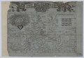
 "I Governi di Woronez di Belgorod di Kiow di Mohilow, e di Nuova Russia".png 1,932 × 1,438; 2.24 MB
-
 Map of Moscow Governorate after 1798.pdf 2,300 × 1,606; 986 KB
-
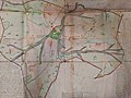
 The plan of the park near the Admiralty. 1790s.jpg 3,496 × 4,383; 2.9 MB
-
 Кильдин на карте 1790 года.jpg 1,000 × 741; 85 KB
.jpg)


