Category:1790s maps of Ontario
Jump to navigation
Jump to search
Subcategories
This category has the following 8 subcategories, out of 8 total.
- 1790 maps of Ontario (1 F)
- 1795 maps of Ontario (2 F)
T
Media in category "1790s maps of Ontario"
The following 11 files are in this category, out of 11 total.
-

-
 Genticore plate, Upper Canada.png 1,280 × 800; 1.27 MB
-
 Plan for the better regulating and laying out the Town of Cornwall.. (I0041121).jpg 7,010 × 7,248; 31.05 MB
-
 Plan for the better regulating and laying out the Town of Cornwall.. (I0041121).tif 7,010 × 7,248; 145.37 MB
-
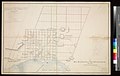 Plan of the Town of Johnstown (I0030680).jpg 9,955 × 6,337; 41.35 MB
-
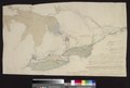
 Sketch Map of Upper Canada ... routes Lt Gov Simcoe took ...1793-5 (I0041118).jpg 9,148 × 5,477; 29.62 MB
-
 Sketch Map of Upper Canada ... routes Lt Gov Simcoe took ...1793-5 (I0041118).tif 9,148 × 5,477; 143.35 MB
-

-
-

-

.jpg)

.jpg)
.jpg)
.jpg)
.jpg)
.jpg)