Category:1780s maps of Italy
Jump to navigation
Jump to search
Countries of Europe: Albania · Armenia‡ · Austria · Azerbaijan‡ · Belgium · Bosnia and Herzegovina · Bulgaria · Croatia · Cyprus‡ · Czech Republic · Finland · France‡ · Georgia‡ · Germany · Greece · Hungary · Republic of Ireland · Italy · Lithuania · Moldova · Netherlands‡ · Norway · Poland · Portugal‡ · Romania · Russia‡ · Serbia · Slovenia · Spain‡ · Sweden · Switzerland · Turkey‡ · Ukraine · United Kingdom
Limited recognition: Abkhazia‡
‡: partly located in Europe
Limited recognition: Abkhazia‡
‡: partly located in Europe
- Regions of Italy: Liguria ·
Subcategories
This category has the following 4 subcategories, out of 4 total.
- 1780 maps of Italy (2 F)
- 1781 maps of Italy (2 F)
- 1783 maps of Italy (2 F)
.
- 1780s maps of Liguria (6 F)
Media in category "1780s maps of Italy"
The following 7 files are in this category, out of 7 total.
-
 William Faden. Composite Mediterranean. 1785.JC.jpg 1,082 × 1,299; 377 KB
-
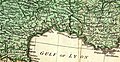
 William Faden. Composite Mediterranean. 1785.LA.jpg 633 × 424; 110 KB
-
 William Faden. Composite Mediterranean. 1785.LB.jpg 848 × 440; 144 KB
-
 William Faden. Composite Mediterranean. 1785.J.jpg 2,086 × 2,619; 1.5 MB
-

-

-
 William Faden. Composite Mediterranean. 1785.JB.jpg 1,101 × 801; 272 KB


