Category:1780s maps of China
Jump to navigation
Jump to search
Countries of Asia: Afghanistan · Armenia‡ · Azerbaijan‡ · People's Republic of China · Cyprus‡ · Egypt‡ · Georgia‡ · India · Indonesia‡ · Iran · Iraq · Japan · Lebanon · Pakistan · Philippines · Russia‡ · Syria · Turkey‡ · Yemen
Limited recognition: Abkhazia‡ · Taiwan · State of Palestine
‡: partly located in Asia
Limited recognition: Abkhazia‡ · Taiwan · State of Palestine
‡: partly located in Asia
Media in category "1780s maps of China"
The following 10 files are in this category, out of 10 total.
-
 Histoire des deux Indes-Atlas-d26-C08-Chine.png 3,147 × 2,329; 2.47 MB
-
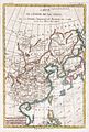 1780 Raynal and Bonne Map of China, Korea, and Japan - Geographicus - Chine-bonne-1780.jpg 1,686 × 2,500; 1.24 MB
-
 Province de Chen-si no. 16 (NYPL b13654478-5053010).tiff 9,756 × 7,699, 2 pages; 215.17 MB
-
 Province de Chen-si no. 16 (NYPL b13654478-5053011).tiff 10,328 × 7,374, 2 pages; 218.16 MB
-
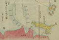 1786年中国往琉球海路图2.jpg 2,130 × 1,450; 325 KB
-
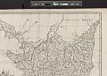
 A map of Chinese Tartary, with Corea (NYPL b13919861-5207424).jpg 8,013 × 6,638; 44.64 MB
-
 A map of Chinese Tartary, with Corea (NYPL b13919861-5207424).tiff 10,326 × 7,758, 2 pages; 229.46 MB
-
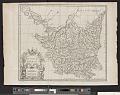
 China, divided into its great provinces, and the Isles of Japan (NYPL b13919861-5207423).jpg 8,045 × 6,648; 44.32 MB
-
 China, divided into its great provinces, and the Isles of Japan (NYPL b13919861-5207423).tiff 6,439 × 4,519; 83.46 MB
-
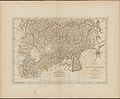
 Rigobert-Bonne-Atlas-de-toutes-les-parties-connues-du-globe-terrestre MG 9996.tif 3,536 × 5,280; 53.45 MB


.jpg)
.jpg)