Category:1778 maps of New Jersey
Jump to navigation
Jump to search
States of the United States: Connecticut · Illinois · Massachusetts · Missouri · New Jersey · New York · Pennsylvania · Virginia
| ← 1770 1775 1776 1777 1778 → |
Media in category "1778 maps of New Jersey"
The following 38 files are in this category, out of 38 total.
-
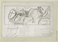
 (Plan of Paulus's Hook and fortifications. LOC gm71002213.jpg 7,636 × 6,835; 4.92 MB
-
 (Plan of Paulus's Hook and fortifications. LOC gm71002213.tif 7,636 × 6,835; 149.32 MB
-

-

-
 Battle of Monmouth, June 28, 1778. LOC gm71002212.jpg 3,120 × 2,219; 957 KB
-
 Battle of Monmouth, June 28, 1778. LOC gm71002212.tif 3,120 × 2,219; 19.81 MB
-
 Battle of Monmouth, June 28th, 1778. NYPL434554.tiff 5,081 × 3,658; 53.2 MB
-
-

-
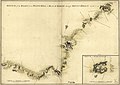
 Map of the environs of Camden, N.J. LOC gm71002187.jpg 3,141 × 2,454; 1.13 MB
-
 Map of the environs of Camden, N.J. LOC gm71002187.tif 3,141 × 2,454; 22.05 MB
-

-

-
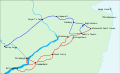 Monmouth1 plainsvg.svg 1,126 × 690; 3.17 MB
-

-

-

-

-
 Plan of Paulus's Hook and fortifications. LOC gm71002214.jpg 6,469 × 5,894; 4.3 MB
-
 Plan of Paulus's Hook and fortifications. LOC gm71002214.tif 6,469 × 5,894; 109.09 MB
-
-

-

-

-

-

-

-

-
 Sketch of the road from Black Horse to Crosswick, LOC gm72003597.jpg 6,586 × 5,824; 3.98 MB
-
 Sketch of the road from Black Horse to Crosswick, LOC gm72003597.tif 6,586 × 5,824; 109.74 MB
-
 Sketch of the road from Black Horse to Crosswick. Sketch of Allen's Town. LOC gm71002190.jpg 7,896 × 5,838; 4.89 MB
-
 Sketch of the road from Black Horse to Crosswick. Sketch of Allen's Town. LOC gm71002190.tif 7,896 × 5,838; 131.88 MB
-
 Sketch of the road from Paulus Hook and Hobocken to New Bridge. LOC gm72003607.tif 7,232 × 8,707; 180.16 MB
-
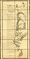
 The Province of New Jersey 1778.jpg 957 × 660; 450 KB
-

-

-

-


_-_NARA_-_102279696.jpg)


.jpg)
.jpg)
.jpg)


