Category:1777 maps of North America
Jump to navigation
Jump to search
Temperate regions: North America · South America · Africa · Europe · Asia · Oceania – Polar regions: – Other regions:
English: 1777 maps of North America
Subcategories
This category has the following 6 subcategories, out of 6 total.
Media in category "1777 maps of North America"
The following 116 files are in this category, out of 116 total.
-
 A map of North and Central America Wellcome V0049921.jpg 3,307 × 2,110; 2.87 MB
-

-

-

-
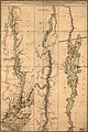
 A map of the Province of New York, with part of Pensilvania, and New England, LOC 74692645.jpg 11,287 × 17,621; 25.73 MB
-
 A map of the Province of New York, with part of Pensilvania, and New England, LOC 74692645.tif 11,287 × 17,621; 569.02 MB
-
 A Map of Ticonderoga with the old and new lines and batteries, LOC 78692736.jpg 3,728 × 2,912; 2.21 MB
-

-

-

-

-
-

-
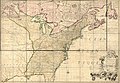
 A new map of the British colonies in North America... (2674323015).jpg 1,547 × 2,000; 2.74 MB
-

-

-

-

-

-

-

-
 A plan of the town of Newport in Rhode Island. LOC 74692104.jpg 4,685 × 4,390; 4.08 MB
-
 A plan of the town of Newport in Rhode Island. LOC 74692104.tif 4,685 × 4,390; 58.84 MB
-
 A plan of the town of Newport in Rhode Island. LOC 74692105.jpg 5,443 × 4,304; 4.39 MB
-
 A plan of the town of Newport in Rhode Island. LOC 74692105.tif 5,443 × 4,304; 67.02 MB
-

-

-

-

-

-
-

-
-
-

-
-

-

-

-
-

-

-

-

-

-

-

-

-

-

-
 Carte des possessions angloises dans l'Amerique Septentrionale. NYPL484203.tiff 6,123 × 4,880; 56.82 MB
-

-

-
-

-

-
 Carte du théatre de la guerre entre les Anglais et les Américains (2674807251).jpg 1,380 × 2,000; 2.6 MB
-
-

-
 Carte du théatre de la guerre entre les Anglais et les Américains- LOC 75690415.jpg 6,269 × 9,119; 10.31 MB
-

-

-
 Coast of New England from Narragansett to Cape Cod RMG K0685.jpg 1,280 × 906; 714 KB
-
 Coast of New England from Narragansett to Cape Cod RMG K0686.jpg 1,280 × 905; 713 KB
-
 Coast of New England from Narragansett to Cape Cod RMG K0687.jpg 1,280 × 963; 775 KB
-

-

-

-

-

-

-
 Five views of New York and approaches RMG K0861.jpg 939 × 1,280; 719 KB
-
 Five views of New York and approaches RMG K0862.jpg 960 × 1,280; 664 KB
-
 Five views of New York and approaches RMG K0863.jpg 997 × 1,280; 808 KB
-
 Four views of Boston Harbour RMG K0296.jpg 1,280 × 946; 780 KB
-
 Four views of Boston Harbour RMG K0297.jpg 1,280 × 941; 800 KB
-
 Four views of Boston Harbour RMG K0298.jpg 1,280 × 955; 799 KB
-

-

-

-

-

-

-

-

-
 Carte des possessions angloises dans l'Amerique Septentrionale (NYPL b13868883-484203).tiff 6,123 × 4,880; 85.49 MB
-
 Carte des possessions angloises dans l'Amerique Septentrionale (NYPL b13868883-484203).jpg 6,123 × 4,880; 7.22 MB
-

-

-

-

-

-
 Province de New-York en 4 feuilles, LOC 74692642.tif 11,794 × 17,650; 595.56 MB
-
 The British colonies in North America. NYPL484202.tiff 577 × 485; 737 KB
-
-

-

-

-

-

-

-

-

-

-

-

-

-
-
 Theatre de la guerre en Amerique (2674327425).jpg 1,517 × 2,000; 2.82 MB
-
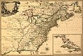
 Theatre de la guerre en Amerique. Seat of war in America. LOC gm71005448.jpg 5,422 × 3,507; 3.06 MB
-
 Theatre de la guerre en Amerique. Seat of war in America. LOC gm71005448.tif 5,422 × 3,507; 54.4 MB
-
 Theatre de la guerre en Amérique. LOC gm71005493.jpg 7,494 × 5,183; 8.5 MB
-
 Theatre de la guerre en Amérique. LOC gm71005493.tif 7,494 × 5,183; 111.13 MB
-

-

-
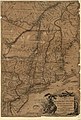
 Virginie, Maryland en 2 feuilles par Fry et Jefferson. LOC 74692503.tif 12,121 × 8,499; 294.73 MB


.jpg)


.jpg)


_-_NARA_-_102279692.jpg)


.jpg)


_de_la_costa_occidental_del_seno_mexicano_comprehendida_desde_la_pta._de_Antn._Lizo._hasta_la_pta._del_N._del_Ro._de_Tampico,_con_todas_las_sondas_qe._se_han_echo_y_reconocido_de_orden_LOC_90683609.jpg)


.jpg)
.jpg)


.jpg)

