Category:1770s maps of the Iberian Peninsula
Jump to navigation
Jump to search
| 18th-century maps of the Iberian Peninsula: ← 1700s 1710s 1720s 1730s 1740s 1750s 1760s 1770s 1780s 1790s → |
Subcategories
This category has only the following subcategory.
P
Media in category "1770s maps of the Iberian Peninsula"
The following 17 files are in this category, out of 17 total.
-

-
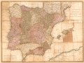
 The kingdoms of Spain and Portugal, divided into their great provinces (20118951603).jpg 2,000 × 1,458; 3.04 MB
-
 The kingdoms of Spain and Portugal, divided into their great provinces. LOC 85694389.jpg 7,858 × 5,838; 7.3 MB
-
 The kingdoms of Spain and Portugal, divided into their great provinces. LOC 85694389.tif 7,858 × 5,838; 131.25 MB
-
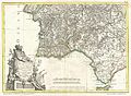
 1775 Janvier Map of Spain and Portugal - Geographicus - SpainPortugal-janvier-1775.jpg 3,500 × 2,406; 2.47 MB
-
-
-

-

-
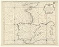 Carte réduite des costes de France de Portugal et d'Espagne - par le S. Bellin - btv1b53052942d.jpg 10,148 × 8,020; 10.95 MB
-
 Carte réduite des costes de France, de Portugal et d'Espagne - btv1b53009389s.jpg 9,645 × 7,804; 11.05 MB
-
 Carte réduite des costes de France, de Portugal et d'Espagne - btv1b53009655w.jpg 10,095 × 7,969; 11.96 MB
-

-
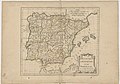
 España y Portugal (1770).jpg 886 × 736; 161 KB
-

-
 Karta över Spanien,1770 - Skoklosters slott - 97983.tif 5,264 × 3,674; 55.35 MB
-
 Regnorum Hispaniae et Portugalliae Tabula generalis 1777.jpg 7,062 × 5,652; 14.19 MB
.jpg)
.jpg)


_Robert_de_Vaugondy_G%C3%A9ographe_ord(inaire)_du..._-_btv1b550137444_(100_of_183).jpg)


.jpg)

