Category:1763 maps of Canada
Jump to navigation
Jump to search
| ← 1760 1761 1763 1764 1767 1768 |
English: Maps of Canada from 1763 or related to Canada in 1763
Français : Les cartes du Canada de 1763 ou se rapportant au Canada en 1763
Media in category "1763 maps of Canada"
The following 4 files are in this category, out of 4 total.
-

-
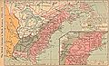 British colonies 1763-76 shepherd1923.jpg 1,651 × 1,010; 625 KB
-
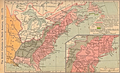 British colonies 1763-76 shepherd1923.PNG 1,651 × 1,010; 3.57 MB
-
 Shepherd - The British colonies in North America, 1763-1775 in Historical Atlas, 1911.xcf 1,896 × 1,348; 5.65 MB

