Category:1750s maps of the Caucasus
Jump to navigation
Jump to search
Media in category "1750s maps of the Caucasus"
The following 6 files are in this category, out of 6 total.
-
 Ca. 1750 manuscript map of the Caspian Sea and the surroundings.jpg 9,543 × 7,997; 13.88 MB
-

-
 Black Sea. Herman Moll. The Turkish Empire in Europe, Asia and Africa. 1752 (cropped).jpg 3,827 × 1,738; 7.84 MB
-

-
 Guillaume Delisle, Carte des pays voisins de la mer Caspiene (FL147398676 2612674).jpg 14,875 × 11,436; 201.12 MB
-
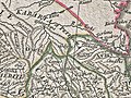 Ghalghaï (Gligvi) on d'Anville's map in 1751.jpg 1,800 × 1,350; 1.24 MB

,_1766_persia_1752_north_west.jpg)
.jpg)

.jpg)
_on_d%27Anville%27s_map_in_1751.jpg)