Category:1745 maps
Jump to navigation
Jump to search
| ← · 1740 · 1741 · 1742 · 1743 · 1744 · 1745 · 1746 · 1747 · 1748 · 1749 · → |
Deutsch: Karten mit Bezug zum Jahr 1745
English: Maps related to the year 1745
Español: Mapas relativos al año 1745
Français : Cartes concernant l’an 1745
Русский: Карты 1745 года
Subcategories
This category has the following 9 subcategories, out of 9 total.
A
- 1745 maps of Africa (14 F)
C
- Cartes et plans de l'Amerique (81 F)
E
N
- 1745 maps of North America (8 F)
S
- 1745 maps of South America (1 F)
Media in category "1745 maps"
The following 64 files are in this category, out of 64 total.
-
 (Plan of Kingston) LOC 2006629864.jpg 6,368 × 4,562; 4.97 MB
-
 (Plan of Kingston) LOC 2006629864.tif 6,368 × 4,562; 83.12 MB
-

-

-

-
 A Plan of English Harbour WDL655.png 1,024 × 1,454; 2.76 MB
-

-

-
 America Map 1745 (rus).jpg 2,247 × 1,845; 2.64 MB
-
 AMH-7903-KB Map of Anjuan.jpg 1,775 × 2,400; 545 KB
-
 Antigua and Barbuda 1745.jpg 2,816 × 4,000; 8.89 MB
-
 Antwerpen 1708-45 Baillieul.JPG 4,199 × 3,207; 12.4 MB
-
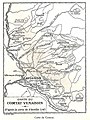 Anville 1745 Carte du Comtat Venaissin.jpg 1,796 × 2,400; 839 KB
-
 Argonauts path Carli.jpg 1,125 × 620; 240 KB
-

-
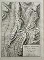 Camp de St. Giacomo et la Neve, en avant de Final le 2 Juillet 1745.jpg 1,191 × 1,599; 454 KB
-
 Carte d'Amérique dressée pour l'usage du Roy - par Guillaume Delisle... - btv1b8469815q.jpg 10,090 × 8,100; 12.81 MB
-
-
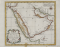
 Carte de la Coste d'Arabie, Mer Rouge, et Golfe de Perse.png 1,347 × 1,024; 2.15 MB
-

-
 Carte Du Golphe Persique (Eliminate background).png 750 × 589; 913 KB
-
 Carte Du Golphe Persique.png 1,398 × 1,024; 2.02 MB
-
 Carte von Ost - Indien (FL35470358 2513852).jpg 4,853 × 8,411; 50.49 MB
-

-
 Christoph Weigel the Elder, Imperium Moscoviae (FL36378775 2605073).jpg 7,168 × 5,727; 57.13 MB
-

-
 George Anson, 1st Baron Anson, A plan of the east end of the island of Quibo (FL37810089 3033951).jpg 14,411 × 8,728; 164.11 MB
-
-

-

-

-

-

-

-

-
 Hotel-de-Blossac---1745.svg 311 × 320; 234 KB
-
 Jacques-Nicolas Bellin, Carte de l'Archipel (FL13730710 3369712).jpg 10,774 × 14,719; 219.4 MB
-
 Johann Christian Rhode, Mappa Mundi Generalis (FL80427988 2725384).jpg 10,684 × 9,018; 102.45 MB
-
 Johann David Köhler, Holy Land (FL13734049 3607376).jpg 3,144 × 3,768; 16.89 MB
-
 John Marchant, A map of ye Holy Land or the Land of Promise (FL46962579 3934716).jpg 5,651 × 2,947; 15.74 MB
-
 Karta över Böhmen, från 1745 - Skoklosters slott - 97964.tif 4,187 × 3,530; 42.3 MB
-

-

-

-

-
-

-

-
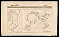
 L' hemisphere meridional pour voir plus distinctement les terres australes LOC 2017585769.tif 6,334 × 5,716; 103.58 MB
-
 Louisburg fortress and harbour RMG F0186.tiff 7,220 × 5,232; 108.08 MB
-
 Map of Ghent by Georges Louis Le Rouge 01.jpg 700 × 478; 98 KB
-
 Martinique 1745.jpg 2,000 × 1,443; 2.57 MB
-
 Matthäus Seuttetre, Ierusalem (FL6881369 2368181).jpg 2,200 × 2,661; 4.13 MB
-

-

-
 Philip Simms, A plan of Jerusalem according to Josephus and ye Rabbies (FL13733971 3532284).jpg 5,477 × 8,236; 74.19 MB
-
 Plan de la bataille de Fontenoy remportée le 11 mai 1745.jpg 5,872 × 4,488; 4.54 MB
-
 Plan de Longwy 1745.jpg 10,896 × 7,898; 13.51 MB
-
 Plentzia eta Urduliz.png 489 × 347; 287 KB
-
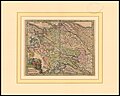
 Priebussischer Creis nebst Herrschaft Muska.png 1,732 × 1,100; 4.47 MB
-
 Richard Pococke, A map of the Holy Land and Syria (FL44436210 2368881).jpg 9,839 × 12,078; 165.4 MB
-
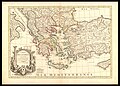 Sir George Wheler, Carte de la Grece (FL35072731 2534527).jpg 17,736 × 12,705; 324.26 MB
-
 Sámuel Mikoviny, Adspice Pisonis, speciosa cacumina, turres (FL39908570 3843876).jpg 17,442 × 8,489; 234.22 MB
-
 Territorio Lugo 1745.jpg 1,372 × 917; 214 KB
_LOC_2006629864.jpg)


.jpg)


.jpg)


.jpg)
.png)

.jpg)
.jpg)
.jpg)
.jpg)
.jpg)
.jpg)
.jpg)
.jpg)
.jpg)
.jpg)
.jpg)
.jpg)
.jpg)

.jpg)
.jpg)
.jpg)
.jpg)


.jpg)
.jpg)
.jpg)


.jpg)
.jpg)
.jpg)
