Category:1720s maps of Louisiana
Jump to navigation
Jump to search
States of the United States: Alabama · Connecticut · Delaware · Florida · Georgia · Louisiana · Maryland · Massachusetts · Mississippi · Missouri · New Jersey · New York · Pennsylvania · Rhode Island · Virginia
Subcategories
This category has the following 2 subcategories, out of 2 total.
- 1728 maps of Louisiana (1 F)
N
- 1720s maps of New Orleans (4 F)
Media in category "1720s maps of Louisiana"
The following 4 files are in this category, out of 4 total.
-

-
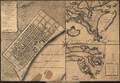
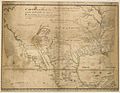 1721 Map of the new part of French Louisiana.jpg 8,104 × 6,291; 14.19 MB
-
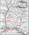 Montigny map with locations.jpg 863 × 1,036; 454 KB
-