Category:1720s maps of Hungary
Jump to navigation
Jump to search
Countries of Europe: Albania · Armenia‡ · Azerbaijan‡ · Belgium · Bosnia and Herzegovina · Bulgaria · Croatia · Cyprus‡ · Denmark · France‡ · Georgia‡ · Germany · Greece · Hungary · Republic of Ireland · Italy · Lithuania · Montenegro · Netherlands‡ · Norway · Poland · Portugal‡ · Romania · Russia‡ · Serbia · Slovenia · Spain‡ · Sweden · Switzerland · Turkey‡ · Ukraine · United Kingdom
Limited recognition: Abkhazia‡
‡: partly located in Europe
Limited recognition: Abkhazia‡
‡: partly located in Europe
Media in category "1720s maps of Hungary"
The following 7 files are in this category, out of 7 total.
-
 1727 map of the Kingdom of Hungary by Seutter.jpg 14,206 × 12,428; 33.86 MB
-
 1729 map of the Balkans by Gerrit van Schagen.jpg 7,269 × 5,737; 9.66 MB
-
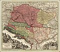
 Ca. 1720 map of the Kingdom of Hungary by Johann Baptist Homann.jpg 27,411 × 23,141; 114.24 MB
-
 Comaromium vulgo Comorn in Danubius Pannonico-Mysicus 1726 by Marsigli.png 1,772 × 920; 990 KB
-
 Esseg (Össeg), Buginovitz, Erdut, Bucovar in Danubius Pannonico-Mysicus 1726 by Marsigli.png 2,953 × 2,144; 3.04 MB
-
 Mining area around Schemnitz in Danubius Pannonico-Mysicus 1726 by Marsigli.jpg 1,032 × 759; 150 KB
-
 Pantali, Postak, Vets in Danubius Pannonico-Mysicus 1726 von Marsigli.png 1,424 × 710; 391 KB


,_Buginovitz,_Erdut,_Bucovar_in_Danubius_Pannonico-Mysicus_1726_by_Marsigli.png)

