Category:1710s maps of the Americas
Jump to navigation
Jump to search
Subcategories
This category has the following 2 subcategories, out of 2 total.
N
S
Media in category "1710s maps of the Americas"
The following 14 files are in this category, out of 14 total.
-

-
-

-

-

-
 America LOC 87691568.jpg 11,661 × 7,476; 15.26 MB
-
 America LOC 87691568.tif 11,661 × 7,476; 249.42 MB
-

-

-
 Frezier Voyage South Sea chart.jpg 1,682 × 2,391; 1.08 MB
-

-
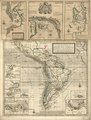
 Map of North and South America, 1719.jpg 850 × 1,021; 182 KB
-

-
 America (NYPL b15351833-433743).jpg 2,730 × 2,320; 1.62 MB


.jpg)


.jpg)


.jpg)