Category:1680s maps of Scotland
Jump to navigation
Jump to search
Media in category "1680s maps of Scotland"
The following 6 files are in this category, out of 6 total.
-
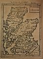
 Map of Scotland and islands north of it, 1685.jpg 642 × 900; 426 KB
-
 Map of Scotland, 1685.jpg 660 × 900; 483 KB
-
 Map of ancient Britain, 1685.jpg 624 × 900; 413 KB
-
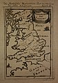 Map of Saxon England, 1685.jpg 630 × 900; 389 KB
-
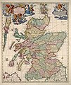 Scotland 1689 map by Nicolaes Visscher II.jpg 5,504 × 6,536; 10.93 MB
-
 UBBasel Map Großbritannien 1685-1686 Kartenslg Mappe 238-4.tif 3,757 × 3,717, 2 pages; 39.98 MB


