Category:1680s maps of North Rhine-Westphalia
Jump to navigation
Jump to search
Federal states of Germany:
Media in category "1680s maps of North Rhine-Westphalia"
The following 9 files are in this category, out of 9 total.
-
 Essen Map 1681.jpg 1,611 × 1,209; 1.05 MB
-
-
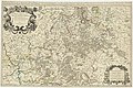
 Le Cercle eslectoral du Rhein... - par le Sr Sanson... - btv1b84465319 (1 of 2).jpg 9,420 × 6,995; 11.41 MB
-
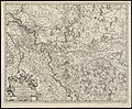
 Le Cercle eslectoral du Rhein... - par le Sr Sanson... - btv1b84465319 (2 of 2).jpg 9,708 × 7,608; 12.5 MB
-

-

-
-

-


.jpg)
.jpg)
.jpg)
.jpg)

.jpg)
.jpg)
.jpg)