Category:1680s maps of Brest (France)
Jump to navigation
Jump to search
Subcategories
This category has the following 2 subcategories, out of 2 total.
1
Media in category "1680s maps of Brest (France)"
The following 11 files are in this category, out of 11 total.
-

-

-
 Carte des environs de Brest - btv1b53153707v.jpg 16,845 × 10,987; 29.14 MB
-
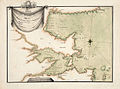 Défense de la rade de Brest et de ses approches.jpg 1,237 × 920; 486 KB
-
-
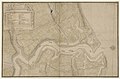
 Plan partiel du quartier de Recouvrance 1682.jpg 1,246 × 776; 479 KB
-
 Route de Brest au royaume de Siam - c 1690.jpg 4,055 × 2,488; 9.07 MB
-

-

-
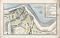
 The BL King’s Topographical Collection- "PLAN DE LA VILLE ET CHASTEAV DE BREST.".jpg 4,000 × 2,788; 1.84 MB
-
 Vue de Brest en rade et plan du banc 1689.jpg 2,744 × 1,058; 863 KB
.jpg)


