Category:1660s maps of Syria
Jump to navigation
Jump to search
Countries of Asia: Azerbaijan‡ · People's Republic of China · Egypt‡ · India · Indonesia‡ · Iran · Pakistan · Russia‡ · Syria · Turkey‡
Limited recognition: Taiwan · State of Palestine
‡: partly located in Asia
Limited recognition: Taiwan · State of Palestine
‡: partly located in Asia
Media in category "1660s maps of Syria"
The following 4 files are in this category, out of 4 total.
-
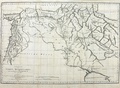 Map of Syria, Mesopotamia and parts of Persia.pdf 1,639 × 1,200; 1.38 MB
-
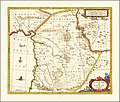
 Syriae sive Soriae (8343849558).jpg 800 × 658; 121 KB
-
 Syriae Sive Soriae Nova et Accurata descriptio by Jan Janssonius.jpg 14,001 × 11,948; 26.79 MB
-
 Syriae Sive Soriae Nova et Accurata descriptio.jpg 13,485 × 11,411; 26.32 MB
.jpg)

