Category:1650s maps of Brazil
Jump to navigation
Jump to search
Subcategories
This category has the following 2 subcategories, out of 2 total.
- 1650 maps of Brazil (3 F)
.
- 1650s maps of Pernambuco (5 F)
Media in category "1650s maps of Brazil"
The following 8 files are in this category, out of 8 total.
-
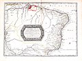 A-3-37-32-Brazil.jpg 3,000 × 2,226; 833 KB
-
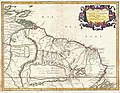 1656 Sanson Map of Guiana, Venezuela, and El Dorado - Geographicus - Guiane-sanson-1656.jpg 4,000 × 3,115; 3.32 MB
-
 Br000002.gif 194 × 150; 11 KB
-

-

-
 Le Bresil. LOC 2003627080.jpg 7,113 × 5,488; 5.58 MB
-
 Le Bresil. LOC 2003627080.tif 7,113 × 5,488; 111.68 MB
-
 Le Perou (4587182588).jpg 2,000 × 1,483; 2.97 MB


.jpg)

.jpg)