Category:1648 maps
Jump to navigation
Jump to search
| ← · 1640 · 1641 · 1642 · 1643 · 1644 · 1645 · 1646 · 1647 · 1648 · 1649 · → |
Deutsch: Karten mit Bezug zum Jahr 1648
English: Maps related to the year 1648
Español: Mapas relativos al año 1648
Français : Cartes concernant l’an 1648
Русский: Карты 1648 года
Subcategories
This category has the following 7 subcategories, out of 7 total.
A
- 1648 maps of Africa (1 F)
- 1648 maps of Asia (empty)
E
G
- 1648 maps of Germany (3 F)
I
U
- 1648 maps of Ukraine (12 F)
Media in category "1648 maps"
The following 14 files are in this category, out of 14 total.
-

-

-

-

-
 Heinrich Bünting, Dese conterfeytinghe der Stadt Jerusalem (FL6879179 2368227).jpg 2,980 × 2,087; 2.99 MB
-
 Heinrich Bünting, Dese vierde Caerte des Heyligen Landts beschryvinge (FL169298906 3495793).jpg 7,212 × 5,508; 37.16 MB
-
 Isle of Ely 1648 by J Blaeu quality50.jpg 4,936 × 6,336; 5.95 MB
-
 Isle of Ely 1648 by J Blaeu.jpg 4,936 × 6,336; 65.43 MB
-
 Joan Blaeu - Map of the World 1648.jpg 2,501 × 1,681; 917 KB
-
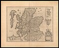 Joan Blaeu, Scotia Regnum (FL35475213 2582188).jpg 14,888 × 12,133; 239.6 MB
-
 Kaart uit 1648 met percelen van de voormalige abdij Oostbroek te De Bilt.jpg 1,400 × 995; 421 KB
-
 Lossy-page1-1171px-Kongo 1648 coloured.png 1,171 × 1,024; 189 KB
-
 Praefectura Apenrade et Luntoft Herde.jpg 7,953 × 6,722; 21.86 MB
-
 Vetus Oceani divisio - btv1b53179367h (1 of 2).jpg 2,504 × 1,832; 797 KB

.jpg)
.jpg)
.jpg)
.jpg)
.jpg)


.jpg)


.jpg)