Category:1490s maps of the world
Jump to navigation
Jump to search
| 15th-century maps of the world: 1400s 1410s 1420s 1430s 1440s 1450s 1460s 1470s 1480s 1490s → |
English: This category is supposed to hold world maps created in the 1490s.
Subcategories
This category has the following 2 subcategories, out of 2 total.
1
Media in category "1490s maps of the world"
The following 20 files are in this category, out of 20 total.
-
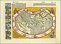
 1490 Ptolemaic world map.jpg 12,926 × 9,070; 14.42 MB
-
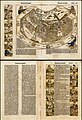
 1493 map of the world by Hartmann Schedel.jpg 13,191 × 10,086; 26.35 MB
-
 Das ander alter der Werlt.jpg 14,458 × 10,459; 37.99 MB
-
 Schedelsche Weltchronik d 013.jpg 5,821 × 4,249; 2.02 MB
-
 Schedelsche Weltchronik — Secunda etas mundi — Folio 12v 13r.jpg 1,600 × 2,345; 5.02 MB
-
 Schedelsche Weltchronik — Secunda etas mundi — Folio 12v.jpg 4,844 × 3,468; 11.43 MB
-
 T and O map from Le mer des hystoires.jpg 9,559 × 7,786; 24.04 MB
-
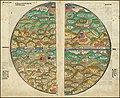
 1493 map of the world - Secunda etas mundi.jpg 13,482 × 9,521; 26.15 MB
-
 Schedel weltkarte.jpg 9,000 × 6,600; 14.71 MB
-
-
 Habitabilis Nostre Tabula (1490).jpg 1,700 × 1,184; 512 KB
-
 Habitabilis Nostre Tabula (1490b).png 3,800 × 2,438; 5.83 MB
-
 Insularium Illustratum (Additional MS 15760, ff.68v-69r).jpeg 7,539 × 5,291; 45.98 MB
-
 KBTG X774 P6A1211.JPG 5,760 × 3,840; 4.82 MB
-
 KBTG X774 P6A1212.JPG 3,840 × 5,760; 6.03 MB
-
 KBTG X774 P6A1234.JPG 3,840 × 5,760; 6.6 MB
-
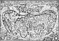
 Martellus-Yale.jpg 1,360 × 776; 773 KB
-

-
 World Chronicle world map 2.jpg 1,024 × 765; 277 KB
-
 World Chronicle world map.png 1,024 × 748; 2.09 MB


.jpg)
.jpg)
.png)
.jpeg)


