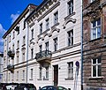
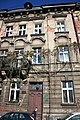
Category:12 Loretańska street in Kraków
Jump to navigation
Jump to search
| Object location | | View all coordinates using: OpenStreetMap |
|---|
 | |||||
| Upload media | |||||
| Instance of | |||||
|---|---|---|---|---|---|
| Location | Kraków, Lesser Poland Voivodeship, Poland | ||||
| Street address |
| ||||
| Heritage designation |
| ||||
| Inception |
| ||||
 | |||||
| Address |
|
Media in category "12 Loretańska street in Kraków"
The following 14 files are in this category, out of 14 total.
-
 617073 Kraków Loretańska 12 kamienica 1.JPG 3,672 × 4,896; 5.78 MB
-
 617073 Kraków Loretańska 12 kamienica 2.JPG 3,672 × 4,896; 6.39 MB
-
 617073 Kraków Loretańska 12 kamienica 3.JPG 4,896 × 3,672; 7.52 MB
-
 617073 Kraków Loretańska 12 kamienica 4.JPG 4,896 × 3,672; 7.74 MB
-
 617073 Kraków Loretańska 12 kamienica 5.JPG 4,896 × 3,672; 5.31 MB
-
 Kamienica - Kraków, ul. Loretańska 12.JPG 3,240 × 4,320; 2.8 MB
-
 Kamienica-UlicaLoretańska12-POL, Kraków.jpg 4,000 × 3,400; 3.81 MB
-
 Kraków, Loretańska 12 (1).JPG 4,752 × 3,168; 7.34 MB
-
 Kraków, Loretańska 12 (4).JPG 3,168 × 4,752; 7.16 MB
-
 Kraków, Loretańska 12 (5).JPG 4,752 × 3,168; 6.46 MB
-
 Kraków, Loretańska 12 (6).JPG 3,168 × 4,752; 6.41 MB
-
 Kraków, Loretańska 12 (7).JPG 4,752 × 3,168; 5.79 MB
-
 Kraków, Loretańska 12 (8).JPG 4,752 × 3,168; 5.63 MB
-
 Kraków, Loretańska 12 (9).JPG 3,168 × 4,752; 7.07 MB


.JPG)
.JPG)
.JPG)
.JPG)
.JPG)
.JPG)
.JPG)